Leilão Bidspirit | Карта Иерусалима, 1572 год Гравюра
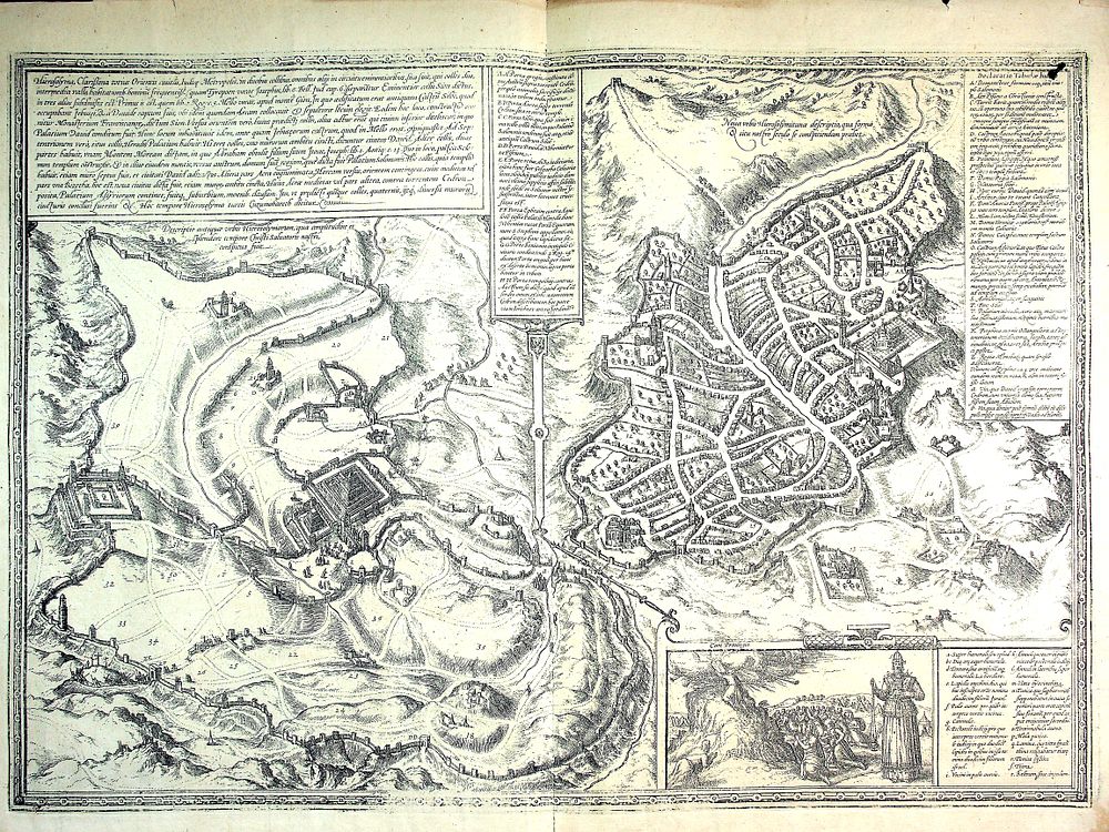
Карта Иерусалима, 1572 год Гравюра на меди из атласа «Civitates Orbis Terrarum» Брауна и Хогенберга. Карта представляет два различных вида города: «Древний Иерусалим» (эпохи Второго Храма) слева и «Современный Иерусалим» (XVI века) справа. В правом нижнем углу помещена иллюстрация: Моисей получает Скрижали Завета на горе Синай, и первосвященник Аарон в облачении. На обороте карты — латинский текст, описывающий завоевание города, описание Храма и др. 53 * 39 см, очень хорошее состояние, один след сгиба. Карта дошла до нас в старой папке, изготовленной по её размеру. Первое издание. Кёльн, 1572. Hierosolyma, Clarissima totius Orientis ciuitas, Iudaeae Metropolis Map of Jerusalem, 1572 Copper engraving from the atlas ”Civitates Orbis Terrarum” by Braun & Hogenberg. The map presents two different views of the city: ”Ancient Jerusalem” (of the Second Temple period) on the left, and ”Modern Jerusalem” (of the 16th century) on the right. In the lower right corner is an illustration of Moses receiving the Tablets of the Law on Mount Sinai, and Aaron the Priest in his priestly garments. On the reverse of the map is a Latin text describing the conquest of the city, a description of the Temple, and more. 53 × 39 cm. Very good condition, one fold line. The map has come to us in an old portfolio made to its size. First edition. Cologne, 1572. מפת ירושלים, 1572 תחריט נחושת מתוך אטלס ”Civitates Orbis Terrarum” מאת Braun & Hogenberg. המפה מציגה שתי תצפיות שונות של העיר: ”ירושלים העתיקה” (מתקופת בית שני) משמאל, ו”ירושלים המודרנית” (של המאה ה-16) מימין. בפינה הימנית התחתונה מופיע איור של משה מקבל את לוחות הברית בהר סיני ואהרון הכהן בבגדי כהונה. מעבר למפה טקסט בלטינית המתאר את כיבוש העיר, תיאור בית המקדש ועוד. 53 * 39 ס”מ, מצב טוב מאוד, סימן קיפול. המפה היגיעה אלינו בתיקיה ישנה המותאמת למידותיה. מהדורה ראשונה. קלן, 1572.