Leilão Bidspirit | Huge Map of Eretz Israel
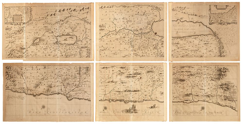
Huge Map of Eretz Israel – Jansson-Hornius Map Based on Adrichem – Amsterdam, 1677 – Engraving Printed on Six Paper Sheets - Huge map of Eretz Israel, divided into the portions of the Twelve Tribes, on both sides of the Jordan, by Jan Jansson and Georg Hornius, based on a map of Eretz Israel by Christian van Adrichem. Engraving printed on six attached sheets of paper. [Amsterdam, ca. 1677]. The map is aligned eastwards and depicts the Land of Israel on both sides of the Jordan, divided into the portions of the tribes. The coast reaches from Sidon in the north to Alexandria in the south; the Stream of Kishon is depicted as a waterway connecting the Sea of Galilee to the Mediterranean Sea. The map is decorated with a plethora of small illustrations depicting scenes from the Old and New Testaments. The Dead Sea features the four cities of Sodom, Gomorrah, Admah and Zeboiim burning. The Mediterranean Sea features Jonah cast from a sailboat into the open mouth of a whale. The land regions incorporate many illustrations, including Abraham's tent, angels climbing a ladder, Moses gazing at the Land across the Jordan, the Children of Israel crossing the Jordan, St. George killing the dragon, scenes from the life of Jesus at the Sea of Galilee, mountain ranges and the cedar forests of Lebanon, and more. Both top corners of the map incorporate two smaller maps. The left-hand map, entitled Peregrinatio Abrahae depicts Abraham's voyage from Ur of the Chaldees to the Land of Canaan. The right-hand map, entitled Itinera et Mansiones Deserti, depicts the wanderings of the Children of Israel in the desert after the Exodus from Egypt and the crossing of the Red Sea. The map is composed of six paper sheets, arranged next to each other in two horizontal strips, with each bearing a separate title in the margin. The two leftmost plates are wider, comprising an additional half sheet each. The present copy was printed without text on verso. This map is based on the work of the 16th-century Dutch theologian Christian van Adrichem, author of the historical atlas Theatrum Terrae Sanctae et Biblicarum Historiarum. Adrichem's map of the Land of Israel, Situs Terrae Promissionis, was first printed posthumously in Cologne, 1590, and served as the basis for most Early Modern printed maps of Eretz Israel. The Dutch publisher and cartographer Jan Jansson expanded and decorated Adrichem's original map. This expanded version was first published in Amsterdam, 1652, in Jansson's atlas of the ancient world, Accuratissima Orbis Antiqui Delineatio. In 1653, the map was reprinted, with historical text by Georg Hornius, a German-born historian and professor active in Holland. The map became known as the Jansson-Hornius map after the collaboration between the two. Map (all parts together): approx. 181X90 cm. Overall good condition. Minor creases and tears to edges. Stains, including dark stain to center. Parts of map housed within two parallel frames. See: Laor 343-349 (Laor dates the map without text on verso to 1677, but it may have been printed in 1652, the date of another map printed without text on verso).