בידספיריט | [ZIONISM] Second year of the
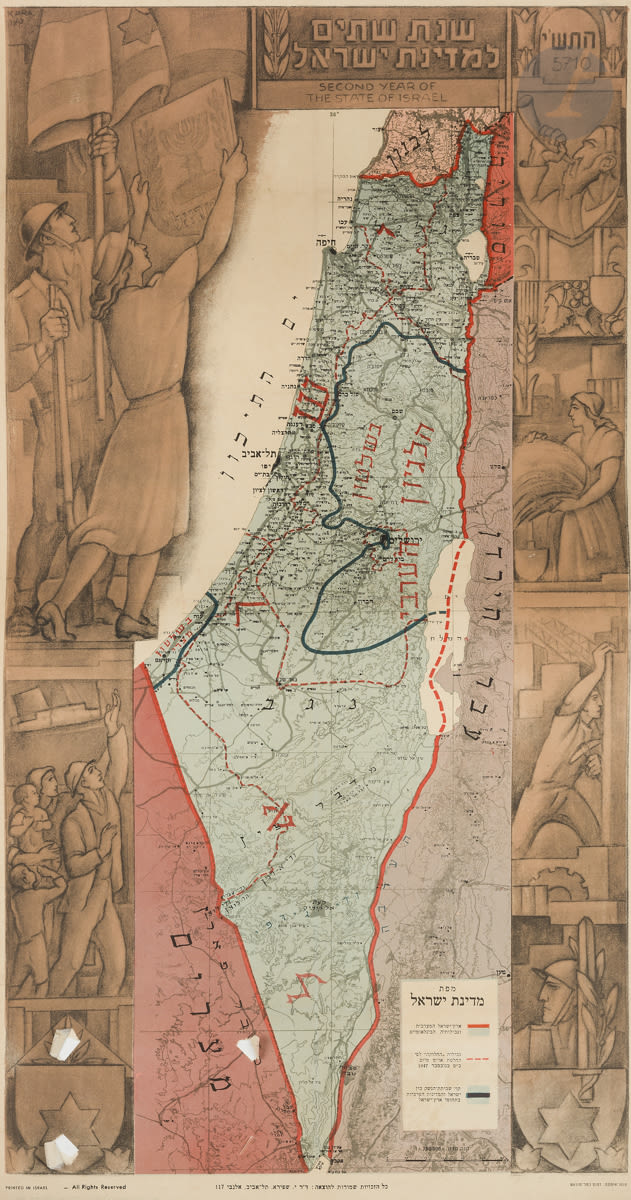
[ZIONISM] Second year of the State of Israel Map of Israel titled in Hebrew and English. Canvas poster designed by Kara and published by Shapiro, Tel Aviv, 1949-1950. 64, 5 x 34 cm. This color map specifies the borders of Israel according to the U.N. as well as the cease-fire lines. The map is illustrated on its sides with pioneers, a woman carrying a sheaf, a rabbi with a shofar.